Paper map for hiking – why you should bring a map to Hossa National Park?
10/03/2026
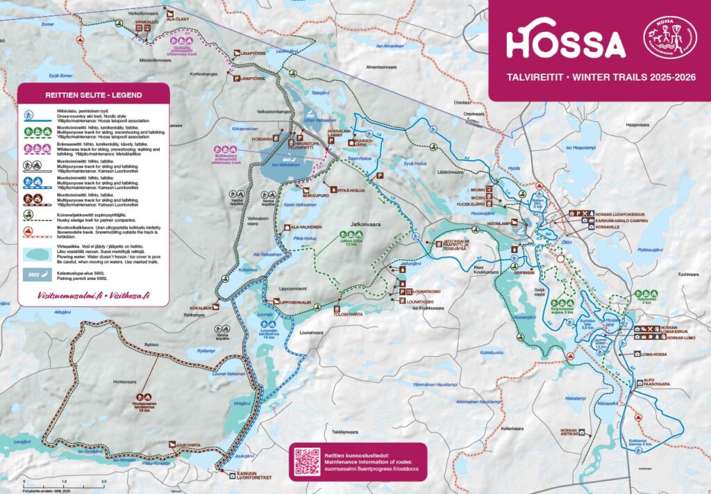
Even in the age of digital navigation, a paper map remains one of the most reliable tools for hikers. The winter trails map of Hossa National Park helps you understand the lakes, ridges and routes at a glance – and works even when your phone battery runs out or the signal disappears.
When planning a hiking trip, many people rely on smartphone navigation and digital maps. Yet a traditional paper map still has an important place in outdoor adventures. With a paper map it is easy to see the entire landscape at once – the lakes, ridges, trails and rest areas all appear clearly in front of you.
In Hossa National Park, a map helps you plan your route before heading out. You can quickly see the length of the trails, alternative routes and places to take a break. Sometimes a simple look at the map also inspires you to explore new areas you might not have noticed otherwise.
A paper map is also a practical backup in nature. It fits easily into a pocket or backpack and does not depend on phone batteries, network coverage or weather conditions. Especially during winter or on more remote trails, having a reliable map can be very useful.
You can pick up the winter trails map of Hossa National Park at the Hossa National Park Nature Centre. It is also a great place to ask for current trail information and hiking tips before starting your adventure.
There is also something special about holding a map in your hands. Looking at the landscape and the map at the same time helps you understand where you are in nature. It slows the pace of the journey and adds to the calm and enjoyment of hiking. For many hikers, a paper map is more than just navigation – it is part of the experience.
The map can also be found in digital format on the Visit Suomussalmi website.